
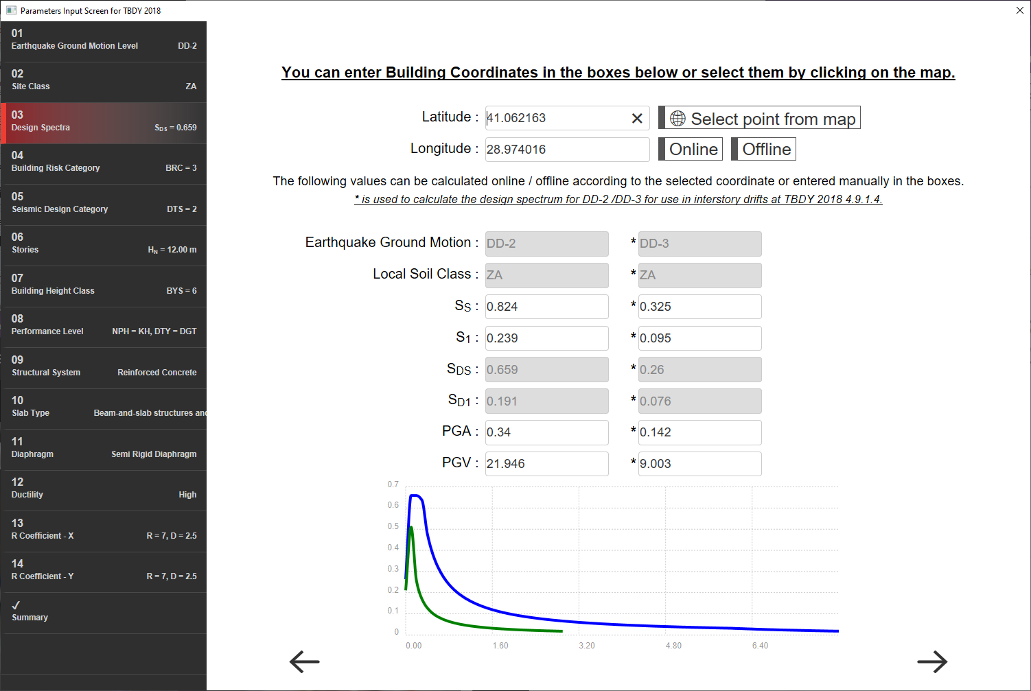
Coordinate information and spectrum information of the structure are entered in this step.
When you click select point from the map, the map will be displayed. When the location of the building is marked on the map, the coordinate information of the building will be automatically added to the latitude and longitude boxes. For more precise data entry, coordinate information can also be written directly into the latitude and longitude boxes.
When clicked online , the page that can log in via e-government will be displayed. On this page, the AFAD map is accessed and the information requested in the dialog for DD-2 and DD-3 earthquake ground motion levels is provided from the reporting menu. This information is written in the relevant boxes in the wizard.
When clicked offline , the program DD-2 and DD-3 columns are automatically filled in according to the coordinates in the latitude and longitude box. Since the program algorithm and AFAD map do not use the same data source, there may be slight differences in values.
Using the information given in the dialog, the design spectra is automatically created by the program.
Next Topic